
Drone Detection Radar: How It Finds Small, Low-Flying Aircraft
How drone detection radar finds small, slow, low-flying aircraft: radar types, clutter and birds, sensor fusion, and what site owners should evaluate.

Drone detection radar can find small unmanned aircraft, but only when the radar is designed for the task and sited with care. Radars built to track airliners often miss a slow, low, small drone, while purpose-built counter-drone radars are tuned for exactly that target. This guide explains how the technology works, why birds and ground clutter cause false alarms, why radar is rarely used alone, and what a site owner should evaluate before buying. Information is current as of October 2026.
Vaubren Systems is a European defence technology company developing aircraft, sensing, electronic warfare and command software as one integrated system.
How drone detection radar works
A radar transmits radio waves and listens for the reflections. By analysing the returned echoes, it determines characteristics such as distance and velocity, which is the basis on which academic reviews of drone detection describe radar as a working method for finding drones. Repeating the measurement many times a second turns single echoes into tracks that show where an aircraft is heading and how fast it moves.
The same review identifies radar’s main advantages as long range and operation in varied weather. Vision sensors, by contrast, depend on weather and lighting. That is why radar is normally the first layer of a counter-drone system: it covers a wide volume of airspace and raises the alert, and other sensors then add detail.
The principal limitation is the same review’s finding on low radar cross-section. A drone returns very little energy, so the radar must be sensitive enough to see it without being so sensitive that it reports everything else too.
Radar types and the frequency trade-off
The designs used for drone work differ in how they scan, what they measure and which frequency band they use. Three practical points matter more to a buyer than the label on the datasheet.
Frequency. An academic assessment of counter-drone effectiveness (2024) notes that higher frequencies allow the detection of smaller objects, but are more heavily attenuated by rain, fog and snow, which limits range. A site in a wet, coastal climate therefore faces a different trade-off from a dry inland one.
Coverage pattern. A surveillance radar may rotate to give all-round awareness, or use fixed faces that each cover a sector. A rotating unit refreshes each part of the sky at intervals, while a fixed-face unit can revisit a sector continuously. Both choices affect how well a fast manoeuvring target is tracked.
Doppler processing. Radars that measure the frequency shift in the echo can separate moving targets from the static background. Specialised micro-Doppler processing goes further, reading the small motions of rotor blades or wings. This is the feature that matters most for telling drones from birds, covered below.
Why small, slow, low-flying drones are hard to see
Three physical facts explain most missed detections.
Small radar cross-section
A 2024 survey of UAV detection, classification and tracking reports that most commercially available UAVs have a radar cross-section below 0.1 m² in the reviewed measurements. It also lists small cross-section, similarity to birds, terrain-hugging flight and clutter as factors that increase the probability of a miss.
Slow flight
Radars that remove stationary returns can also suppress a target that moves slowly or hovers. The US Defense Systems Information Analysis Center states (2020) that radar is the primary small-UAS detection modality because of its range and all-weather sensitivity, yet low-speed Class 1 and Class 2 UAS may be missed by radars designed to track larger aircraft.
Plastic and lightweight airframes
Can radar detect plastic drones? Yes, but less easily. A 2020 millimetre-wave measurement study from Finland found plastic and styrofoam airframes less visible to radar than larger carbon-fibre drones. It also found that a drone’s battery can contribute substantially to the radar return, even when the airframe is small and made of non-reflective material. A plastic drone is therefore harder to detect, not invisible, and the result depends on what is inside it.
Clutter, birds and false alarms
A drone detection radar usually looks low, close to the ground, where buildings, trees, hills and vehicles also reflect energy. The 2024 UAV survey cited above notes that clutter from such objects can have a cross-section thousands of times larger than an aerial vehicle. The same survey observes that high range resolution helps separate aircraft from clutter and improves the signal-to-clutter ratio.
Birds are the other persistent source of false alarms. A bird and a small drone can have similar cross-sections and speeds. What differs is the motion of their moving parts. A June 2025 report from the US Office of Scientific and Technical Information explains that radar can distinguish drones from birds using their different micro-Doppler signatures, including helicopter rotor modulation (HERM) lines for rotors and the pattern of wing beats for birds. It adds that machine learning can help differentiate them.
For a site owner, the lesson is practical. A radar that reports every bird as a threat will train operators to ignore it. Ask suppliers how classification is performed, what training data was used, and how the system behaves at your site during the bird seasons that matter locally.
How far can radar detect a drone?
Range claims vary widely, and they depend on transmitted power, target cross-section, clutter and weather. As reference points from independent sources:
- DSIAC reports (2020) that purpose-built counter-UAS radars commonly detect small UAS at roughly 1 to 3 km, depending on transmitted power and target cross-section.
- A 2026 field validation of an integrated counter-UAS system in Thailand demonstrated detection of Class 1 and Class 2 drones at distances up to 4 km when 3D surveillance radar was integrated with other sensors.
These figures describe particular systems and trials, not a guarantee for any product or site. Detection range alone also says little about warning time. A drone detected at 3 km and a drone that is detected only after it drops below a tree line behind a hill are different problems, and terrain masking often matters more than the datasheet range.
Why radar is not enough on its own
The European Commission’s Joint Research Centre, in its 2024 report Counter-drone systems and data fusion, states that a counter-UAS architecture relying on one sensor is significantly constrained. Effective systems use multi-sensor data fusion, combining radar with electro-optical and infrared cameras, passive radio frequency sensors, or both, to improve detection, tracking and identification when individual observations are incomplete.
Each sensor contributes something different:
| Sensor | What it adds | Main limitation |
|---|---|---|
| Radar | Wide-area, all-weather detection and tracking of position and velocity | Low cross-section targets, clutter, bird confusion |
| Passive radio frequency sensing | Detection of control and video links, often with an indication of drone type | Silent or autonomous drones that do not transmit |
| Electro-optical and infrared cameras | Visual confirmation and higher target resolution | Weather, lighting and narrow field of view |
| Acoustic sensors | Bearing and classification at short distance | Short range and ambient noise |
A 2021 peer-reviewed review of counter-UAS sensors describes the same division of labour: radar detects targets approaching the area, acoustic sensors add bearing and classification, optical and infrared sensors improve target resolution, and fusion algorithms such as Kalman filtering track targets.
Passive radio frequency sensing is the natural partner for radar because the two fail in different ways. A drone flying a pre-programmed route may emit no control link and escape radio detection, while a drone hovering behind clutter may be missed by radar and still betray itself through its link. Sector analysis from Vaubren’s own guide to drone detection systems takes the same layered view.
The role of command software
Adding sensors does not automatically improve awareness. The 2021 review above emphasises that fusion software must solve spatial and temporal synchronisation, correlate observations belonging to the same drone, filter tracks and predict motion. Otherwise, extra sensors can create association errors in place of reliable awareness. The JRC report likewise lists sensor heterogeneity, misalignment, synchronisation and data association as the problems fusion must address.
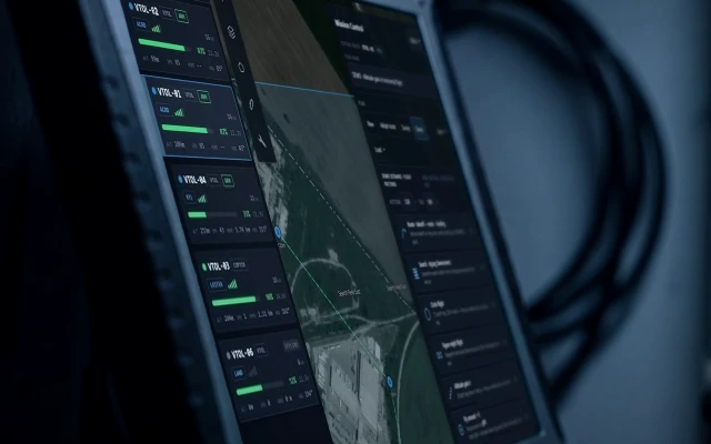
In practice that means one drone should appear as one track on one screen, whether it was first seen by radar, a radio frequency sensor or a camera. It also means the operator, not the algorithm, decides what happens next. The US Federal Aviation Administration’s technical considerations for UAS detection note that radar systems can depend on trained operators to track detections and choose system settings, although some can automatically cue electro-optical systems to the target.
Vaubren is developing Redoubt, command and control software that plans missions, shows one live picture and keeps a person in command of every use of force. Redoubt is in development and evaluation. Related design questions for the operator interface are covered in Vaubren’s article on UAV ground control stations.
What site owners should evaluate
A procurement team or infrastructure operator comparing drone detection radar should test the system against its own conditions. The following criteria separate a credible system from a brochure.
- Target set. Which drone sizes and materials were used in the supplier’s trials, and does that include small, plastic, low-flying aircraft similar to what you expect?
- Site geometry. Request a coverage analysis against your terrain, buildings and trees. Terrain masking and multipath reflections cut detection in ways a range figure does not show. The FAA considerations cited above list interference from equipment, multipath, trees, terrain, moisture and wind.
- False alarm management. Ask how birds, vehicles and wind-blown vegetation are handled, and request recorded data from comparable sites.
- Sensor fusion. Establish whether radar, radio frequency and camera data are correlated into single tracks, and whether the system cues a camera automatically.
- Operator workload. Count the settings, the alerts per hour and the training the system needs. A trained operator is a cost as well as a capability.
- Spectrum and licensing. The FAA guidance points to site-specific spectrum licensing. Radars transmit, so confirm the regulatory position with the national spectrum authority before installation.
- Power and mobility. A remote coast, port or border site may have no grid connection, so power supply and set-up time are part of the evaluation.
- Data handling. Check how tracks are recorded, who owns the data and whether the system can integrate with existing command and control.
- Sovereignty and support. For critical infrastructure, ask where the software is developed, who can service it and who controls updates.
Sector analysis points to a simple test: run the supplier’s system at your site, with your drone types and your local birds, before signing.
Where Bartizan fits
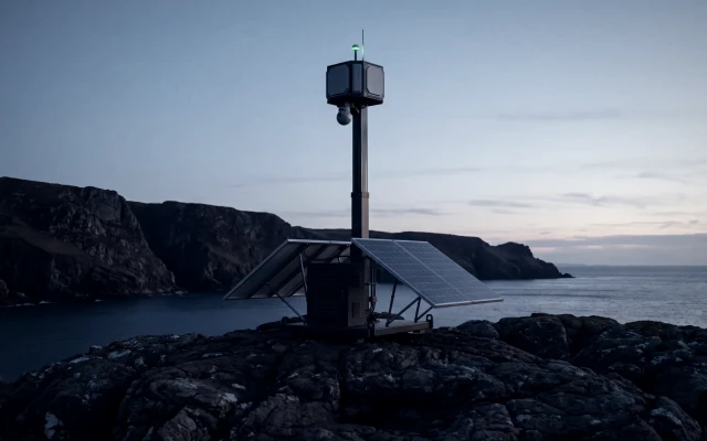
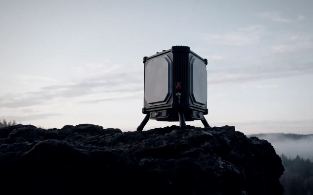
Vaubren’s Bartizan is a self-powered sensing tower with radar, radio detection and cameras for coasts, ports, borders and critical sites. It is a concept in development, and Vaubren publishes no performance figures for it. The design answers several criteria above: it places radar, radio frequency detection and cameras on one tower, and it addresses sites where grid power is not available.
Bartizan is intended to feed Redoubt, so that detections from the tower appear in the same live picture as Vaubren’s aircraft. Organisations assessing wider site protection can read Vaubren’s overview of counter-drone systems and its page on border and coastal surveillance. For electronic warfare against hostile drones, Vaubren is developing Stillpoint, a portable counter-drone electronic warfare unit, also a concept in development. For aircraft-based response, Ravelin is a printed counter-drone interceptor, a prototype in testing. Capability, procurement and integration teams can see the full range on the Vaubren Armory page or start a conversation through the Vaubren website.
Common questions about drone detection radar
Can a drone be picked up on radar?
Yes. Radar transmits radio waves and analyses the reflected echoes to determine distance and velocity, and academic reviews treat it as a primary drone detection method. Detection depends on the radar type, the drone’s size and materials, its altitude and the clutter around it. Radars built for larger aircraft may miss small, slow drones.
Can radar detect plastic drones?
Usually, but with more difficulty. A 2020 measurement study found plastic and styrofoam airframes less visible than larger carbon-fibre drones, and that the battery can contribute substantially to the radar return. Combining radar with radio frequency sensing and cameras reduces the chance of a miss.
How does radar tell a drone from a bird?
By micro-Doppler signature. Rotating drone blades and beating wings modulate the echo differently, and a June 2025 US report describes rotor lines for drones and wing-beat patterns for birds, with machine learning helping to separate them. No classification is perfect, so operators should expect some false alarms and ask suppliers how they are managed.
Is radar alone enough to protect a site?
No. The European Commission’s Joint Research Centre describes single-sensor architectures as significantly constrained and recommends fusing radar with cameras and passive radio frequency sensors. Command software then has to correlate the observations into one track, with a trained operator making the decisions.
Sources
- Advances and Challenges in Drone Detection and Classification (PMC, 2023)
- Methods for Assessing the Effectiveness of Modern Counter-UAS (MDPI Remote Sensing, 2024)
- Detection and Classification of Small UAS for Threat Neutralization (DSIAC, 2020)
- Field Validation of an Integrated Counter-UAS System (2026)
- Analyzing Radar Cross Section Signatures of Diverse Drone Models (2020)
- US Office of Scientific and Technical Information report on drone and bird radar signatures (June 2025)
- A Survey on Detection, Classification, and Tracking of UAVs (arXiv, 2024)
- Counter-drone systems and data fusion (European Commission Joint Research Centre, 2024)
- Review and Simulation of Counter-UAS Sensors for Unmanned Aircraft Systems (PMC, 2021)
- Unmanned Aircraft Systems Detection Technical Considerations (US FAA)
About Vaubren
Vaubren is a European defence technology company developing aircraft, command software, sensing and electronic warfare as one integrated system, with a person in command of every use of force.
More insights
Critical Infrastructure Protection Against Drones in EuropeHow airports, ports, energy sites and borders protect critical infrastructure from drones: layered detection, response options, and NIS2 and CER duties in Europe.Mobile Surveillance Towers: Borders, Ports and Critical SitesHow a mobile surveillance tower works: sensors, power and links, the GDPR and EU rules that apply, and how towers pair with aircraft and command software.Drone Detection Systems: How They Work and How to ChooseHow drone detection systems work: radar, radio frequency, cameras and acoustic sensors, sensor fusion, false alarms and coverage for critical sites.