

Drone Detection Systems: How They Work and How to Choose
How drone detection systems work: radar, radio frequency, cameras and acoustic sensors, sensor fusion, false alarms and coverage for critical sites.
A drone detection system finds, tracks and classifies unmanned aircraft in a defined area, then passes that information to the people responsible for the site. It does this by combining sensors, most often radar, radio frequency receivers, electro-optical and infrared cameras, and sometimes acoustic arrays, with software that fuses their output into one picture. This guide explains what each sensor does well, where it fails, and how to judge a system for a coast, port, border or critical site.
This guide is written by Vaubren, the European defence technology company developing Vanguard, Cobra, Citadel, Headland and Stillpoint as one integrated system. The analysis draws on EU, NATO and Joint Research Centre sources.
TL;DR
- No single sensor is enough. The European Commission’s Joint Research Centre stresses that counter-drone systems need data fusion to cope with weather, darkness and false alarms.
- Radar gives wide-area warning, radio frequency detection gives identity clues, cameras confirm what a track is, and acoustic sensors add a passive layer at short distance.
- Autonomous drones that emit no radio signal weaken any design that relies on radio detection alone.
- Choose against your site: terrain, clutter, birds, weather, power, mobility and the command software that receives the tracks.
- Vaubren’s Headland applies this principle in one self-powered tower that combines radar, radio detection and cameras.
Table of Contents
- What a drone detection system does
- The main sensor types
- Why sensor fusion matters
- False alarms and how to manage them
- Planning coverage for coasts, ports, borders and critical sites
- Detection is not the whole system
- How Vaubren approaches detection
- How to choose a drone detection system
- Working with Vaubren
- FAQ
- Sources
What a drone detection system does
Detection is the first stage of a longer chain. The JRC’s report on counter-drone systems and data fusion describes the problem as unauthorised use of unmanned aircraft that can be legitimate, a nuisance or malicious, and treats sensing, tracking and decision support as parts of one system.
In practice a system performs four tasks:
- Detect: register that something is in the airspace.
- Track: hold a stable position over time so the object can be followed.
- Classify: decide whether it is a drone, a bird, a light aircraft or clutter.
- Report: present the track to an operator with enough context to decide what happens next.
Detection systems are passive in effect: they observe. What follows, whether that is a police response, a site lockdown or an electronic or kinetic measure, is a separate decision with its own legal and operational framework. Commercial vendors describe the wider category in similar terms. Dedrone, for example, describes a drone defence system as security technology that detects, tracks and identifies uncrewed aircraft and sometimes mitigates them.
The main sensor types
Radar
Radar transmits energy and measures what returns. It works day and night, in most weather, and does not depend on the drone emitting anything. That makes it the usual backbone for wide-area warning.
Its weakness is discrimination. Small drones return little energy and move slowly, much like birds. The JRC notes that radar struggles to separate drones from other moving objects without additional sensor data, which is the main driver of false alarms. Clutter from waves, vegetation, vehicles and buildings adds to the problem, and a coastal or port site has plenty of all four.
Radio frequency detection
Radio frequency (RF) receivers listen for the control link, video link or telemetry between a drone and its pilot. When a drone uses a recognised protocol, RF detection can indicate the type of aircraft and sometimes the pilot’s position. It is passive, so it does not announce itself.
Its limit is equally clear. The JRC points out that many detection approaches rely on communication signatures, and that autonomous drones without an active radio link get around them. A site that plans only for radio-controlled hobby drones will be exposed to aircraft flying a pre-programmed route.
Electro-optical and infrared cameras
Electro-optical (EO) cameras give a visual image in daylight. Infrared (IR) cameras work from heat and extend coverage into darkness. Their value is confirmation: an operator or classification algorithm can see whether the track is a quadcopter, a fixed-wing aircraft or a gull.
Cameras have a narrow field of view, so they are normally cued by another sensor and steered onto a track rather than scanning the whole sky. Fog, rain and glare reduce their range, which is why the JRC lists adverse weather and night operation among the central technical challenges.
Acoustic sensors
Microphone arrays pick up the sound of rotors and motors. They are passive and cheap to add, and they can detect aircraft that are hidden from line of sight. Range is short, and wind, traffic, industrial noise and the sea all degrade performance. They suit a supporting role, particularly close to a protected asset. A NATO Science and Technology Organization paper on automatic classification of mini-UAVs shows that classification of small aircraft is an active research problem, not a solved one.
Comparison at a glance
| Sensor | Strength | Main limitation | Typical role |
|---|---|---|---|
| Radar | Wide-area detection, day and night, no emissions needed from the drone | Confuses small drones with birds and clutter | Early warning and tracking |
| RF detection | Passive, can indicate drone type and pilot position | Blind to drones with no active radio link | Identification and attribution clues |
| EO and IR cameras | Visual confirmation, night capability with IR | Narrow field of view, weather sensitive | Classification of cued tracks |
| Acoustic | Passive, works without line of sight | Short range, noisy environments | Close-in supporting layer |
The table states qualitative strengths only. Actual ranges depend on the product, the drone and the environment, and you should ask any supplier for evidence from tests that resemble your site.
Why sensor fusion matters
The JRC’s position is that no single sensor is sufficient, and that integration into a unified system is critical to decision-making. Fusion means correlating the output of several sensors so that each compensates for the others.
A typical sequence looks like this. Radar reports a slow, small track. The software cues a camera to that bearing. The camera image, plus any RF activity in the same sector, lets the system label the track as a drone, a bird or unknown. Each added source reduces the number of unresolved tracks an operator has to handle.
Fusion also has to be honest about uncertainty. A good interface shows how a classification was reached and how confident the system is, instead of presenting every track as certain. When an operator is going to decide on a response, that transparency matters more than a clean display.
NATO treats this as an interoperability question as much as a sensing one. Its Communications and Information Agency reported on the fourth Counter-UAS Technical Interoperability Exercise, C-UAS TIE24, which brought together military, scientific and industry specialists to test commercial solutions. NATO’s own news report says more than 60 counter-drone systems and technologies were tested, including sensors, drone-on-drone systems, jammers and cyber interceptors, in the 2024 exercise. The lesson for buyers is that open interfaces and a common air picture decide whether sensors from different suppliers can work together.
False alarms and how to manage them
False alarms are the most common reason operators stop trusting a detection system. They come from a few predictable sources:
- Birds, especially at long range and over water or open ground.
- Clutter, such as waves, trees moving in wind, vehicles and cranes.
- Legitimate aircraft, including light aircraft, helicopters and authorised drones.
- Electromagnetic interference, which affects RF receivers in busy urban or industrial settings.
The JRC identifies the high rate of false alarms from non-cooperative moving objects as a core challenge. Ways to reduce it, without making claims about any particular product, include:
- combining radar with EO, IR or RF data before raising an alert;
- using track behaviour, such as altitude profile and manoeuvring, as a classification input;
- keeping a list of authorised flights so known drones are filtered out;
- tuning thresholds to the site rather than accepting factory defaults;
- recording tracks so that false alarms can be reviewed and the system adjusted.
When you test a system, ask for the false alarm behaviour at your own location, over a long enough period to include different weather, bird activity and traffic. A demonstration on a clear day over flat ground tells you little about a harbour in winter.
Planning coverage for coasts, ports, borders and critical sites
The right layout depends on what you are protecting and what the terrain does to your sensors.
Coasts and ports. Sea clutter, gulls, cranes and moving vessels make radar tuning difficult. Cameras help confirm tracks, and sites often need coverage that reaches over the water because approach is possible from any direction. Salt, wind and humidity affect equipment, so ask about environmental protection and maintenance.
Borders. Long, thinly populated lines are hard to cover with fixed installations alone. Power and communications are often the limiting factors, which favours towers that carry their own power and can relay data over resilient links.
Critical infrastructure. Energy sites, airports and government buildings usually sit within urban radio noise and often near legitimate air traffic. Here, classification quality and integration with existing security teams matter more than raw reach.
Temporary sites and events. Mobility becomes decisive. Reporting on a live-fire demonstration in Poland, NATO Allied Land Command described a mobile system that combines radar, electro-optical sensors and a small interceptor drone, used by air defenders from three nations on light tactical vehicles. The modular approach shows how much weight users place on moving and setting up quickly.
A practical coverage plan usually follows these steps:
- Define the asset and the airspace you need to protect, including the warning time you need.
- Map terrain, buildings, water and sources of radio and acoustic noise.
- Identify legitimate air activity: flight paths, approved drone operations, bird habitats.
- Place sensors to remove blind spots, and check for overlap so one failure does not leave a gap.
- Decide how tracks reach operators and who is authorised to act on them.
- Trial the layout over weeks, not hours, and adjust.
Detection is not the whole system
Detection feeds decisions. The sector increasingly treats sensing, command software and response options as one chain. The European Parliamentary Research Service notes that the EU has funded military drone and counter-drone research since 2015, with approximately €68 million allocated to counter-drone systems under the 2023 European Defence Fund work programme alone. The European Commission also publishes a factsheet on drones and counter-drone projects funded through the EDF, which is a useful place to see how European programmes frame the field.
For a buyer, this means asking three questions of any detection system. Can it share tracks through open interfaces? Does the command software keep a person in charge of every decision? Can the system grow, adding sensors or response options, without replacing what you have bought?
How Vaubren approaches detection
Vaubren designs aircraft, sensing, electronic warfare and command software as one integrated system for European defence, so detection, decision and response are built to work together rather than bought as separate products. The company, founded by Rafael Zard and incorporated in Bulgaria, sets out its approach on its mission and systems pages.
The systems that cover the detection chain, all in development:
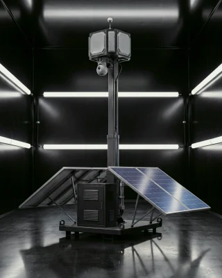
- Headland is a self-powered sensing tower with radar, radio detection and cameras, intended for coasts, ports, borders and critical sites.
- Citadel is command and control software that plans missions, shows the live air picture and keeps a person in command of every decision. It is in development and evaluation.
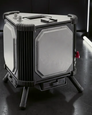
- Stillpoint is a portable counter-drone electronic warfare unit.
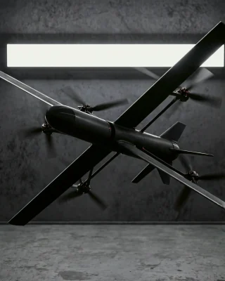
- Cobra is a fast, printed counter-drone interceptor, a second-generation prototype in development.
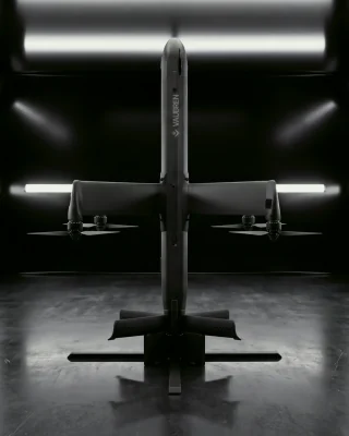
- Vanguard is a vertical take-off strike and interception aircraft, also in development.
Headland combines the three sensor types discussed above, radar, radio detection and cameras, in one tower. That reflects the fusion principle in the JRC’s analysis: radar for wide-area awareness, radio detection for identity clues, and cameras for confirmation. Its power is self-contained, which matters where mains supply is unavailable, such as remote border sections.
Tracks from Headland flow into Citadel, where a person decides whether Stillpoint or Cobra responds. Development, testing and manufacturing are planned at Arsenal, Vaubren’s campus in Bulgaria, inside the European Union and NATO.
How to choose a drone detection system
Use criteria you can test and a supplier can evidence.
| Criterion | What to ask |
|---|---|
| Sensor mix | Which sensors are included, and what does the system do against drones that emit no radio signal? |
| Fusion and classification | How are tracks correlated, and how is the confidence of a classification shown? |
| False alarm record | What results exist from sites similar to yours, over what period? |
| Environment | How does it handle your weather, sea state, terrain and radio noise? |
| Power and mobility | Can it run without mains power, and how quickly can it be moved or redeployed? |
| Integration | Are interfaces open, and can tracks reach your existing command systems? |
| Human control | Who authorises an active response, and is that recorded? |
| Legal and regulatory fit | Which frequencies, data and mitigation actions are permitted in your country? |
| Sovereignty and support | Where is the system designed and maintained, and who controls updates? |
| Evidence | Is there independent testing, such as an interoperability exercise, and what were the conditions? |
Treat headline range figures with caution. A range quoted against one drone type in clear conditions will not carry over to a smaller aircraft in rain.
On cost, prices for these systems are generally agreed under contract and depend on the sensor mix, the number of sites and support terms. There is no authoritative public price list, so a costed proposal tied to your own coverage plan is the only reliable basis for comparison.
Working with Vaubren
If you are a procurement, capability or innovation team, or a research or industry partner working on detection and sensing, start with the Headland page and discuss requirements through Vaubren’s contact page. Engineers interested in aerospace, embedded systems and software for European defence can see planned roles on the careers page.
FAQ
Is there a device to detect drones?
Yes. Devices range from handheld radio frequency detectors to fixed radar and camera installations. Each type has blind spots, which is why professional sites combine several sensors. For critical sites, a single handheld device is rarely enough.
How does a drone detection system tell a drone from a bird?
It combines evidence. Radar provides position and movement, cameras provide an image, and radio detection shows whether a control link is present. The JRC notes that radar alone has difficulty separating drones from other moving objects, so fusion with other sensors is used to reduce false alarms.
Can radio detection find every drone?
No. Radio detection depends on the drone transmitting. The JRC warns that autonomous drones without an active radio link get around detection methods based on communication signatures. Radar and cameras, or passive techniques, are needed to cover those aircraft.
How much does a drone detection system cost?
It depends on the sensors, the number of sites and the support package, and suppliers generally quote per project. There is no authoritative public price list. Ask for a costed proposal tied to your own coverage plan, including training, maintenance and updates.
Is Headland available to buy?
Headland is in development. Procurement and partner teams can discuss requirements and evaluation with Vaubren through its contact page.
Sources
- Counter-drone systems and data fusion, Joint Research Centre
- Automatic classification of UAVs, NATO Science and Technology Organization
- NATO tests counter drone technology during interoperability exercise, NCI Agency, 19 September 2024
- Ukraine joins NATO counter-drone exercise for first time, NATO News, 19 September 2024
- NATO Allies demonstrate counter-UAS capability during live-fire demonstration in Poland, Allied Land Command, 2025
- Military drone systems in the EU and global context, European Parliamentary Research Service, 2025
- Drones and counter-drone systems factsheet, European Commission, December 2025
Recommended
This article is general information drawn from public sources. Vaubren systems mentioned here are in development.